
Getting to
THE CORE
getting to
THE CORE
By Car - Via US 75
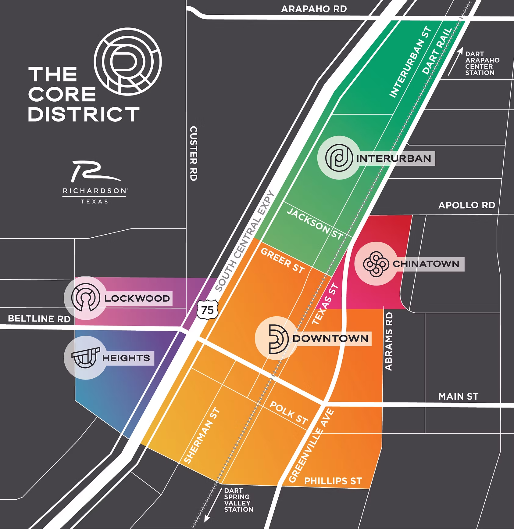
The CORE District is conveniently located off US 75. As you exit Beltline Road in Richardson, the Richardson Heights and Lockwood areas are located on the west side of US75 and the Main Street, Chinatown, Interurban, and Spring Valley areas are located on the east side.
By Transit - Via Light Rail & Bus
Richardson is a DART member community and is serviced by both rail and bus. The DART Spring Valley Station is located in the Spring Valley area and a short 10 minute walk to the Main Street area via Central Trail. If visiting a business in the Interurban or Chinatown areas, the DART Arapaho Center Station is more convenient. There are also several DART bus stops in The CORE District. Download DART’s GoPass app to plan your next trip.
By Trail - Via Central Trail
Central Trail connects to Spring Creek Trail to the north and runs south all the way to the city limits, roughly parallel to US 75. The Central Trail forms the central spine of the city’s trail system, which covers more than forty miles of trails and walkways and connects Richardson’s four light rail stations to The CORE District. Central Trail runs directly though the Chinatown, Interurban, Downtown, and Spring Valley areas and is less than a 10 minute walk to the Heights and Lockwood neighborhoods.
CORE District Area Map

CHINATOWN

DOWNTOWN

HEIGHTS

INTERURBAN